Skip to content

The hiking guide

Long days,
deep in the forest.

The New Forest is rarely steep and always slow — gravel tracks, tussocky heath and riverside paths that take a whole afternoon to walk properly. These are the full-day routes: six to eleven miles each, all started from a village with coffee at the other end.

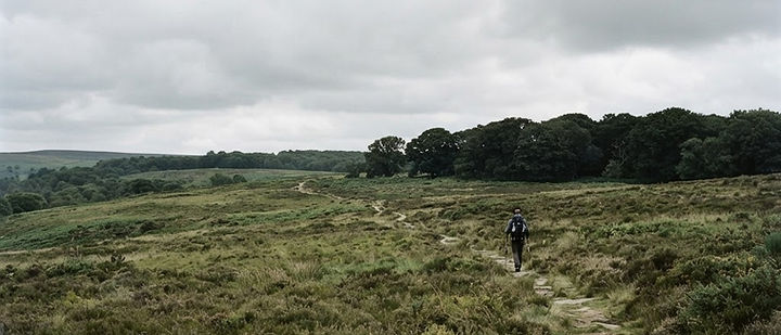
A long-distance footpath crossing open heathland with oak woodland on the skyline

High heath north of Fritham, on a long afternoon

Route lengths
6 – 11 miles
Terrain
Wood, heath, coast
Season
All year

Before you go

Four things worth knowing

Nothing is waymarked

The New Forest is deliberately free of signposts. Carry OS Explorer OL22 in paper or on your phone, and know the car park you started from by name — it is what a rescue will ask for.

Heath is slow ground

Allow 25 minutes a mile on gravel, closer to 35 on tussocky heath or after rain. The muddiest stretches hide in the birch scrub, not on the open tops.

Water and loos are rare

Villages at Brockenhurst, Burley, Lyndhurst and Beaulieu have both. Between them, expect nothing but a pub, so carry water and plan the day around a refuel.

Livestock have right of way

Ponies, cattle and donkeys share every path. Walk around them, keep dogs close, do not pass between a foal and its mother, and close any gate you open.

The routes

Six to eleven miles, shortest first

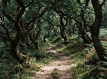
A sandy path through ancient oak woodland with dappled light
Out to Bolderwood and back · indicative
01

Brockenhurst to Bolderwood

Woodland · around 9 miles

The best full day in the forest, and the one to do first: out of Brockenhurst on the old enclosures, through the oak and beech woods north of the village, and on to the deer sanctuary at Bolderwood before looping back on the rides. It mixes everything the New Forest is good at — ancient woodland, open heath, gravel tracks and a tea stop at either end.

Good to know — Paths are not waymarked in the forest, so carry OS Explorer OL22 or a charged phone. The Balmer Lawn and Bolderwood car parks both work as a start.

Distance
Around 9 miles
Time
4.5 – 5.5 hours
Start
Brockenhurst
Terrain
Wood & gravel track
Directions
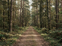
A broad gravel forest track running between tall pines and beech
Knightwood and Rhinefield loop · indicative
02

Knightwood Oak & Rhinefield

Tall trees · around 7 miles

The oldest tree in the forest and the tallest conifers in England in the same afternoon. Start at the Knightwood Oak, walk the Rhinefield Ornamental Drive between giant redwoods and Douglas firs, then take the wooded tracks south towards Brockenhurst before returning through the enclosures. Nearly all of it runs on proper gravel, which makes it the most forgiving big walk here after rain.

Good to know — The ornamental drive is a road — walk it early before the cars. Dogs off lead only where you can see them, as ponies stand in the trees.

Distance
Around 7 miles
Time
3.5 – 4.5 hours
Start
Knightwood Oak
Terrain
Gravel track
Directions
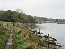
A riverside footpath along a calm tidal river with moored dinghies
River and heath circuit · indicative
03

Beaulieu River to Buckler's Hard

Riverside · around 8 miles

A gentle, waterlogged-in-a-good-way sort of day. Follow the Beaulieu River down through the woods from Beaulieu village to the shipbuilding hamlet of Buckler's Hard, where warships were built on the mud, then return along the higher ground through the New Forest show ground and back to the village. Water on both sides, oaks overhanging, hardly a hill.

Good to know — The river path floods after heavy rain — there is a drier line through the woods marked on the OS map. The museum and café at Buckler's Hard run year-round.

Distance
Around 8 miles
Time
4 hours
Start
Beaulieu village
Terrain
Riverside, flat
Directions
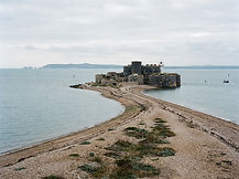
The low round stone walls of Hurst Castle on its shingle spit, sea on both sides
Coast path to Hurst Castle · indicative
04

Lymington to Hurst Castle

Coast · around 11 miles

The long coastal day. Leave Lymington along the Solent Way, past the saltmarsh and the boatyards at Keyhaven, and out along the shingle spit to Hurst Castle with the Needles across the water. It is flat and utterly exposed, and the light on the water does most of the work. For a shorter version, park at Keyhaven and do just the spit.

Good to know — No shelter between Keyhaven and the castle. Catch the small ferry back from the castle in season, or plan a taxi from Keyhaven if the legs give out.

Distance
Around 11 miles
Time
5 – 6 hours
Start
Lymington Quay
Terrain
Flat coastal path
Directions
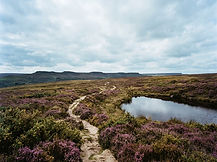
Open high heathland with a sandy track and a small dark pond reflecting the sky
Fritham and Cadman's Pool · indicative
05

Fritham & Cadman's Pool

High heath · around 8 miles

The emptiest part of the forest, and the one that feels most like moorland. From the Royal Oak at Fritham, climb onto the high heath and wander between Cadman's Pool, the old gravel workings and the best big skies in Hampshire. Excellent in late summer when the heather is out, and excellent again in winter when the puddles are frozen and nobody else is there.

Good to know — Much of this area is boggy underfoot and lightly trodden. Take water — the pub at Fritham is the only option, and it stops serving mid-afternoon.

Distance
Around 8 miles
Time
4 – 5 hours
Start
Fritham
Terrain
Rough heath & track
Directions
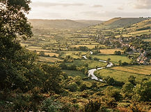
A view from a wooded hill across valley fields and hedgerows
Burley Hill and the Avon edge · indicative
06

Burley Hill & the Avon valley

Valley views · around 6 miles

The short big-view walk. Head out of Burley village and up onto the ridge, where the ground drops away to the west and the Avon valley opens up beyond the forest boundary. Come back along the wooded lanes and heath edge, with the option of a very good pub lunch at the halfway point. The best pick if you want a proper hill in a few hours.

Good to know — The climb comes early. Keep dogs on leads through the village and past the free-roaming livestock on the heath.

Distance
Around 6 miles
Time
3 hours
Start
Burley village
Terrain
Hill, wood & heath
Directions

After something shorter? The walking guide covers the two-hour woodland circuits, and the stays collection has places to sleep within walking distance of each start.

More guides

Sponsorship

Put your business in front of visitors planning a New Forest break — in town guides, our outdoor pages, the diary and the directory.

Promote your business