Skip to content

The walking guide

Six walks, from
an hour to a whole day.

You can walk for a week in the New Forest without repeating a path. These are the six we come back to: woodland circuits under old oaks, river paths, and open heath where the view does the work.

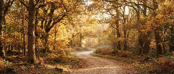
Gravel riding track through oak woodland in bright autumn light

Gravel rides, oak woods, and no particular hurry

Waymarked trails
140+ miles
Routes here
Six
Best months
Apr – Oct

Before you go

Four things worth knowing

Gravel, not mud

Most waymarked rides are gravel and drain well. The exceptions are the clay tracks of the south — after heavy rain they hold water for days.

Ponies have right of way

Walk around them, keep dogs on a lead near livestock, and never feed them. They are not tame and they do bite.

Free parking, small car parks

Forestry England car parks are free at most trailheads, but spaces are limited and gates close at dusk.

Carry a map

Phone signal is patchy across the heath. The Ordnance Survey New Forest map, or the Explore New Forest app offline, is worth the download.

The walks

Shortest first

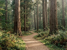
Gravel path curving between towering redwoods on the Tall Trees Trail
1.5 mile circuit · indicative
01

The Tall Trees Trail, Rhinefield

Rhinefield Ornamental Drive · SO42

A short, gentle circuit through Blackwater Arboretum and the towering redwoods and Wellingtonias planted along Rhinefield Drive in the 1850s. Gravel underfoot the whole way, with giant sequoias you can walk right up to and a picnic clearing in the middle. The best introduction to the forest if you have an hour and small legs in the party.

Good to know — The car park is small and closes at dusk. Combine it with a drive along the Ornamental Drive itself.

Distance
1.5 miles
Time
About 1 hour
Gradient
Flat, easy
Surface
Gravel, buggy-friendly
Directions
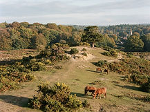
Ponies grazing on the sandy knoll at Bolton's Bench near Lyndhurst
3 mile loop · indicative
02

Lyndhurst & Bolton's Bench

Lyndhurst · SO43

A three-mile loop from the village that climbs gently onto Bolton's Bench, the sandy knoll that has been the forest's unofficial front garden for two centuries. Ponies graze among the gorse, and the return drops through beech woods and back along the high street. Start it early and you'll have the bench to yourself.

Good to know — Parking in Lyndhurst is tight in summer — use the village car parks, not the verges.

Distance
3 miles
Time
1.5 hours
Gradient
One short climb
Start
Lyndhurst village
Directions
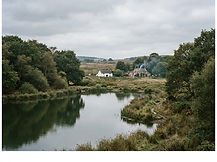
Still green water and reeds at Eyeworth Pond with open heath beyond
4 mile circuit · indicative
03

Eyeworth Pond & Fritham

Fritham · SO43

A four-mile circuit through the quiet north of the forest, past the still green water of Eyeworth Pond and out onto open heath where the only sound is Skylarks. It finishes beside the Royal Oak at Fritham, a proper two-room forest pub with cider and no music — which is the whole point of walking here.

Good to know — The path holds water after rain. Boots rather than trainers, and a torch if you're walking back late.

Distance
4 miles
Time
2 hours
Gradient
Gentle undulation
Finish
Pub at Fritham
Directions
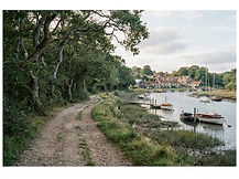
Riverside path under oaks on the way from Beaulieu to Buckler's Hard
River path to Buckler's Hard · indicative
04

Beaulieu to Buckler's Hard

Beaulieu · SO42

A river walk rather than a forest one: three and a half miles along the Beaulieu River, past the palace and the boatyards, to the Georgian shipbuilding village of Buckler's Hard. Oaks, saltmarsh and moored boats most of the way, with the option of returning by the same path or catching a lift back.

Good to know — Buckler's Hard has a café and museum. The path is level and mostly dry, good winter walking.

Distance
3.5 miles
Time
1.5 – 2 hours
Gradient
Flat
Surface
Firm track
Directions
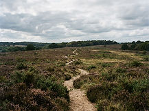
Sandy path through heather and gorse on the open heath above Burley
Village and hill loop · indicative
05

Burley & Castle Hill

Burley · BH24

From the village, a four-and-a-half-mile loop out across the heath to Castle Hill, an Iron Age earthwork with the best view in the western forest. The first mile is easy going; then the sandy tracks open out and the horizon disappears. Gorse, larks and a great deal of sky, with tea shops waiting at the end.

Good to know — There's little shade. Carry water in warm weather and avoid the open heath during a heatwave.

Distance
4.5 miles
Time
2 – 2.5 hours
Gradient
Moderate, sandy
Start
Burley village
Directions
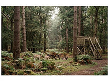
Fallow deer among beech trees near the viewing platform at Bolderwood
Woodland loop from the car park · indicative
06

Bolderwood & the Deer Sanctuary

Bolderwood · SO43

A two-and-a-half-mile circuit from the Bolderwood car park, combining the deer viewing platform with an easy woodland loop through beech and conifer. Fallow deer are fed here most afternoons in spring and summer, best viewed from the platform rather than the fence. A good short walk with children who need a destination.

Good to know — Deer viewing is best from around 2pm in summer. Do not approach animals on the open forest.

Distance
2.5 miles
Time
1 – 1.5 hours
Gradient
Gentle
Extras
Deer platform, toilets
Directions

Walk it, then sleep on it — find a stay within walking distance of the trailheads at Brockenhurst, Burley and Lyndhurst.

More guides

Sponsorship

Put your business in front of visitors planning a New Forest break — in town guides, our outdoor pages, the diary and the directory.

Promote your business